Popular Tours






Exploring Hoi An Ancient Town becomes much easier when you understand the layout of its streets, landmarks, and walking routes. A Hoi An Ancient Town map helps visitors quickly locate historic houses, temples, museums, and riverside spots while planning a smooth walking journey through the UNESCO-listed Old Town. In this guide by Hoi An Unique Travel, you’ll discover the main streets of Hoi An, a suggested walking route, and the top attractions marked on the map, along with nearby destinations worth visiting.
A Quick Look at the Hoi An Ancient Town Map
Hoi An Ancient Town is relatively compact, stretching along the banks of the Thu Bon River and covering only a small area of the city. Most of its historic attractions are concentrated within a network of parallel streets running east–west, intersected by smaller lanes that create an easy-to-navigate grid.
Key features you’ll typically find on a Hoi An Ancient Town map include:
- The Japanese Covered Bridge, one of the town’s most iconic historical landmarks
- Major pedestrian streets such as Tran Phu Street and Nguyen Thai Hoc Street, where many heritage buildings are located
- Cultural sites like assembly halls, temples, and centuries-old merchant houses
- The scenic riverside promenade along Bach Dang Street, overlooking the Thu Bon River
Thanks to this compact layout and pedestrian-friendly streets, Hoi An Ancient Town is best explored on foot. With a simple map in hand, visitors can comfortably wander through lantern-lit alleys, historic houses, and lively local markets without worrying about getting lost.
Map of Hoi An Ancient Town: Main Streets
Tran Phu Street – The Historic Heart of Hoi An
Tran Phu Street is considered the cultural backbone of Hoi An Ancient Town. Many of the town’s best-preserved heritage buildings are located here.
Highlights on this street include:
- Ancient merchant houses with traditional wooden architecture
- Assembly halls built by Chinese communities
- Museums showcasing Hoi An’s trading history
Walking along Tran Phu Street feels like stepping back into the 17th century when Hoi An was a major Southeast Asian trading port.
>>> View more: Nguyen Tuong Family Chapel Hoi An: A Cultural Heritage House

Nguyen Thai Hoc Street – Museums and Ancient Houses
Running parallel to Tran Phu Street, Nguyen Thai Hoc Street is one of the most vibrant cultural streets marked on the Hoi An Ancient Town Map. The street is lined with well-preserved historic buildings that reflect the town’s rich trading heritage.
Things to explore here include:
- Historic merchant houses such as Tan Ky Ancient House
- Small museums and local art galleries showcasing traditional culture
- Tailor shops, handicraft stores, and souvenir boutiques
Walking along Nguyen Thai Hoc Street offers a unique blend of history, culture, and daily local life. With traditional architecture, charming cafes, and bustling shops, the street captures the timeless atmosphere that makes Hoi An Ancient Town so special.
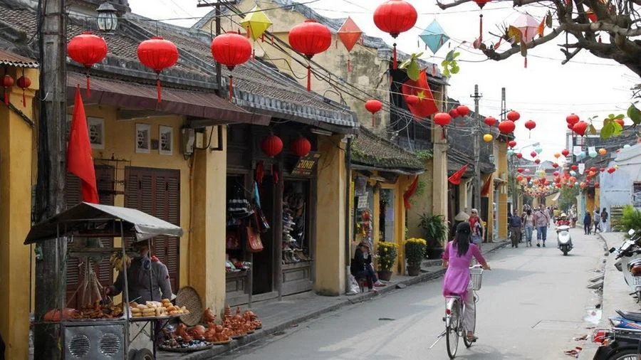
Bach Dang Street – Riverside Views of the Thu Bon River
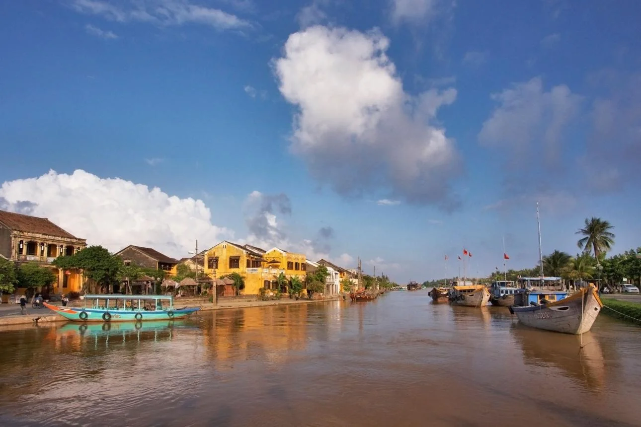
Running alongside the Thu Bon River, Bach Dang Street is one of the most scenic locations highlighted on the Hoi An Ancient Town Map. This riverside street offers a peaceful contrast to the bustling historic lanes, with open views of the river and plenty of spots to relax.
Visitors often come here to:
- Enjoy sunset views over the Thu Bon River
- Watch traditional wooden boats drifting along the water
- Visit cafes and restaurants with beautiful riverside seating
In the evening, Bach Dang Street becomes even more enchanting as colorful lanterns illuminate the riverfront and their reflections shimmer on the water, creating one of the most memorable night scenes in Hoi An Ancient Town.
>>> View more: Museum of Sa Huynh Culture Hoi An: A Complete Visitor Guide
Phan Chau Trinh Street – The Vibrant Walking Street at Night
Located slightly north of the historic core, Phan Chau Trinh Street is another notable area you can find on the Hoi An Ancient Town Map, especially for those interested in evening activities and local nightlife.
The street is well known for:
- Bustling night markets with a variety of local goods and souvenirs
- Local restaurants and street food stalls serving traditional Vietnamese dishes
- Lantern-lit pedestrian areas that create a lively evening atmosphere
As night falls, Phan Chau Trinh Street becomes one of the most vibrant parts of Hoi An, filled with visitors, glowing lanterns, and the sounds of street vendors and cafes. It’s a great place to experience the energetic side of the Old Town after sunset.
>>> Explore Hoi An Cycling Tour and experience the countryside at your own pace.



Hoi An Ancient Town Walking Map
Since the Old Town is compact, many of its key landmarks are clustered close together. With our Hoi An Ancient Town map, you can easily follow a self-guided, 2-to-3-hour walking route that covers the most famous historical streets. A Suggested Half-Day Walking Route:
- Japanese Covered Bridge: Start your walk at this iconic 16th-century symbol of Hoi An.
- The Old House of Phung Hung: Just steps away from the bridge, admire this two-story blend of Vietnamese, Japanese, and Chinese architecture.
- Tran Phu Street & Assembly Halls: Walk east along Tran Phu to visit the Cantonese Assembly Hall, followed by the spectacular Fujian Assembly Hall.
- Tan Ky Ancient House: Cut across to Nguyen Thai Hoc Street to explore this perfectly preserved 200-year-old merchant home.
- Hoi An Market: Continue east to experience the bustling local food stalls and vibrant atmosphere.
- Thu Bon River (Bach Dang Street): End your journey along the scenic riverfront. Grab a coffee, or wait for the sunset to see the lantern-lit boats.
Pro Tip: While a self-guided map is great, the history of these ancient walls is best brought to life by an expert. Consider booking a private walking tour with Hoi An Unique Travel. Our local guides will navigate the map for you, sharing deep historical insights and hidden photo spots you won’t find in standard guidebooks.
>>> View more: Hoi An Tours & Private Luxury Experiences | Hoi An Unique Travel
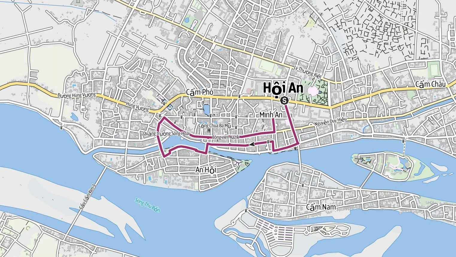
Top Attractions on the Hoi An Ancient Town Map
Exploring the Hoi An Ancient Town map reveals many cultural landmarks, historic houses, temples, and lively markets. These attractions highlight the town’s rich history as an international trading port from the 15th to 19th centuries and remain essential stops for visitors discovering the Old Town.
Japanese Covered Bridge
Built in the late 16th century, the Japanese Covered Bridge (Chua Cau) is one of the most iconic landmarks on the Hoi An Ancient Town Map. The bridge was originally constructed by the Japanese community living in Hoi An to connect their quarter with the Chinese neighborhood across a small canal.
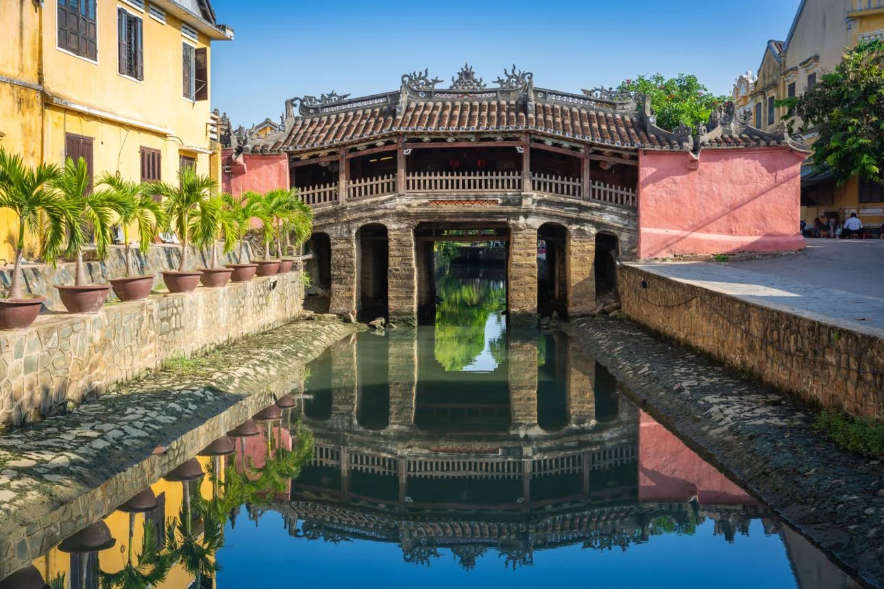
The structure features a unique wooden roof, intricate carvings, and guardian statues of dogs and monkeys at its entrances. Inside the bridge sits a small temple dedicated to the Taoist deity Tran Vo Bac De, believed to protect the area from natural disasters.
Today, the bridge is not only a historical monument but also one of the most photographed spots in Hoi An, especially when the surrounding lanterns illuminate the area at night.
>>> View more: Museum of Sa Huynh Culture Hoi An: A Complete Visitor Guide
Quan Cong Temple
Quan Cong Temple, also known as Ong Pagoda, is a significant religious site located along Tran Phu Street. The temple is dedicated to Quan Cong (Guan Yu), a legendary Chinese general admired for his loyalty, bravery, and integrity.
The temple complex is known for its vibrant red gates, dragon carvings, incense-filled courtyards, and colorful statues. Local residents often visit to pray for prosperity, protection, and success in business.
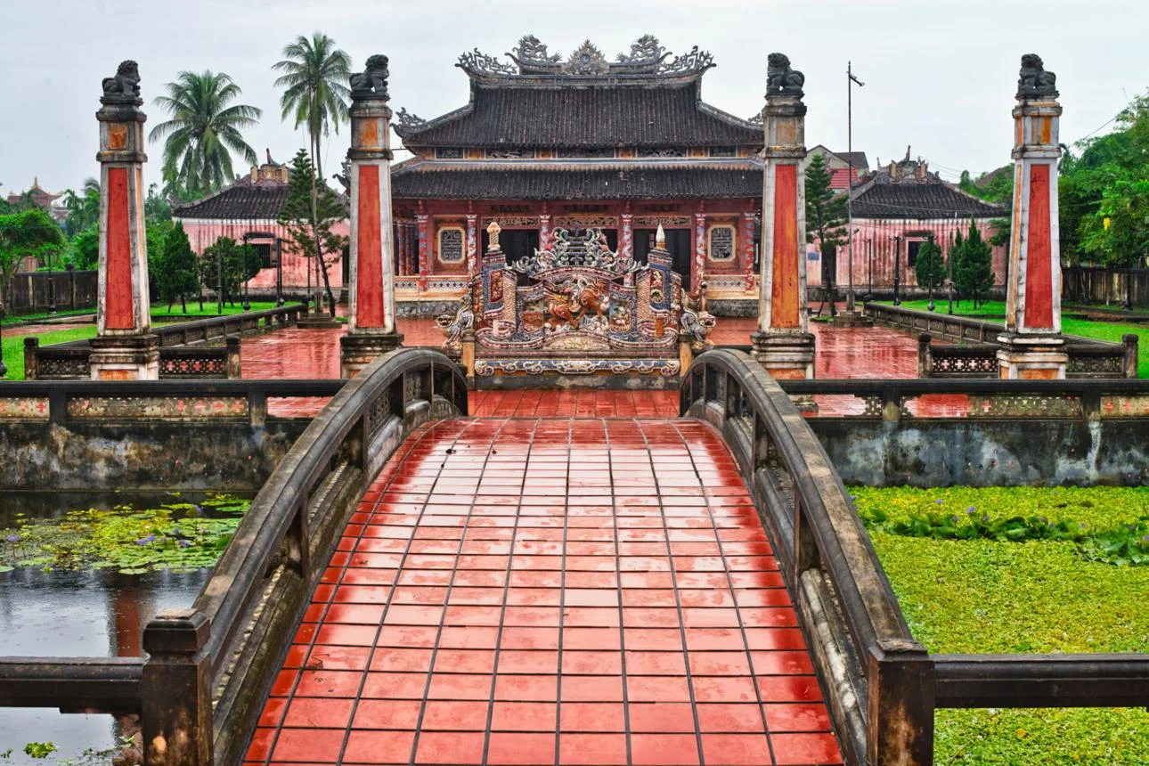
Precious Heritage Art Gallery Museum
The Precious Heritage Art Gallery Museum offers a deeper look into Vietnam’s diverse ethnic cultures. Founded by French photographer Réhahn, the museum displays powerful portraits, traditional costumes, and cultural artifacts from Vietnam’s 54 ethnic groups.
The exhibitions focus on preserving disappearing traditions and stories from remote communities across the country. Visitors can explore several galleries featuring photography collections, cultural artifacts, and documentary displays.
Unlike many historic sites in the Old Town, this museum provides a modern cultural perspective, making it a unique highlight on the Hoi An Ancient Town Map.

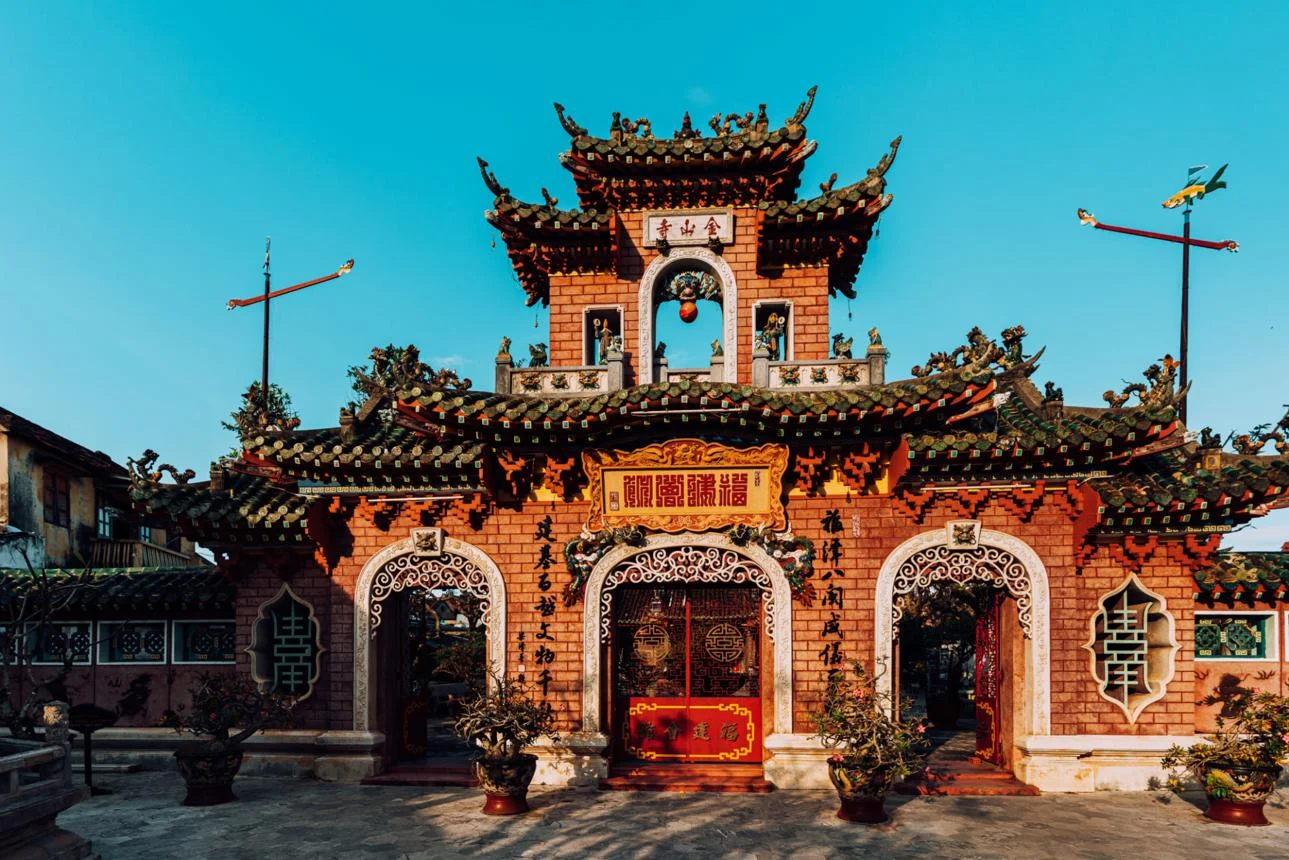
Phuc Kien Assembly Hall
The Phuc Kien Assembly Hall, also called the Fujian Assembly Hall, was built in the 17th century by Chinese merchants from Fujian province. Originally used as a community gathering place, it later became a temple dedicated to Thien Hau, the goddess believed to protect sailors and fishermen.
The complex features ornate gates, colorful dragon sculptures, incense-filled courtyards, and beautifully decorated altars. Its detailed architecture reflects strong influences from traditional Chinese temple design. As one of the most impressive religious sites in the Old Town, the assembly hall is a must-see location on the Hoi An Ancient Town Map.
Cantonese Assembly Hall
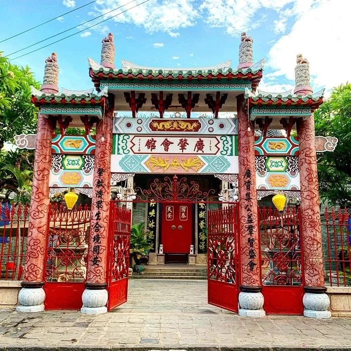
The Cantonese Assembly Hall (Quang Trieu Assembly Hall) represents the Cantonese community that once played an important role in Hoi An’s trading history.
Built in the late 19th century, the hall is known for its impressive dragon statue fountain, detailed ceramic decorations, and elegant courtyard. Inside the hall, visitors can see statues dedicated to Quan Cong and other revered figures. The hall’s elaborate design and cultural significance make it another important landmark marked on the Hoi An Ancient Town Map.
Tan Ky Ancient House
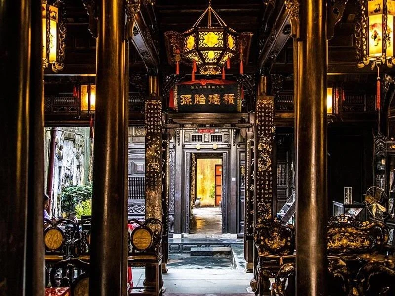
Tan Ky Ancient House is one of the best-preserved merchant houses in Hoi An. Built more than 200 years ago, the house belonged to a prosperous trading family and still remains owned by their descendants today. The architecture combines Vietnamese, Chinese, and Japanese influences, featuring wooden beams, carved columns, and a central courtyard designed to allow natural light and airflow.
The Old House of Phung Hung
The Old House of Phung Hung is another remarkable historic residence located near the Japanese Covered Bridge. Built over 200 years ago, the house once belonged to a successful trading family.
The building features two floors, a wooden balcony decorated with lanterns, and intricate carved details. Its elevated structure was designed to protect the house from seasonal flooding from the Thu Bon River. Today, the house serves as both a historical attraction and a living example of traditional architecture in Hoi An.
>>> View more: Ultimate Guide to the Best Time to Visit Hoi An: Weather & Seasons
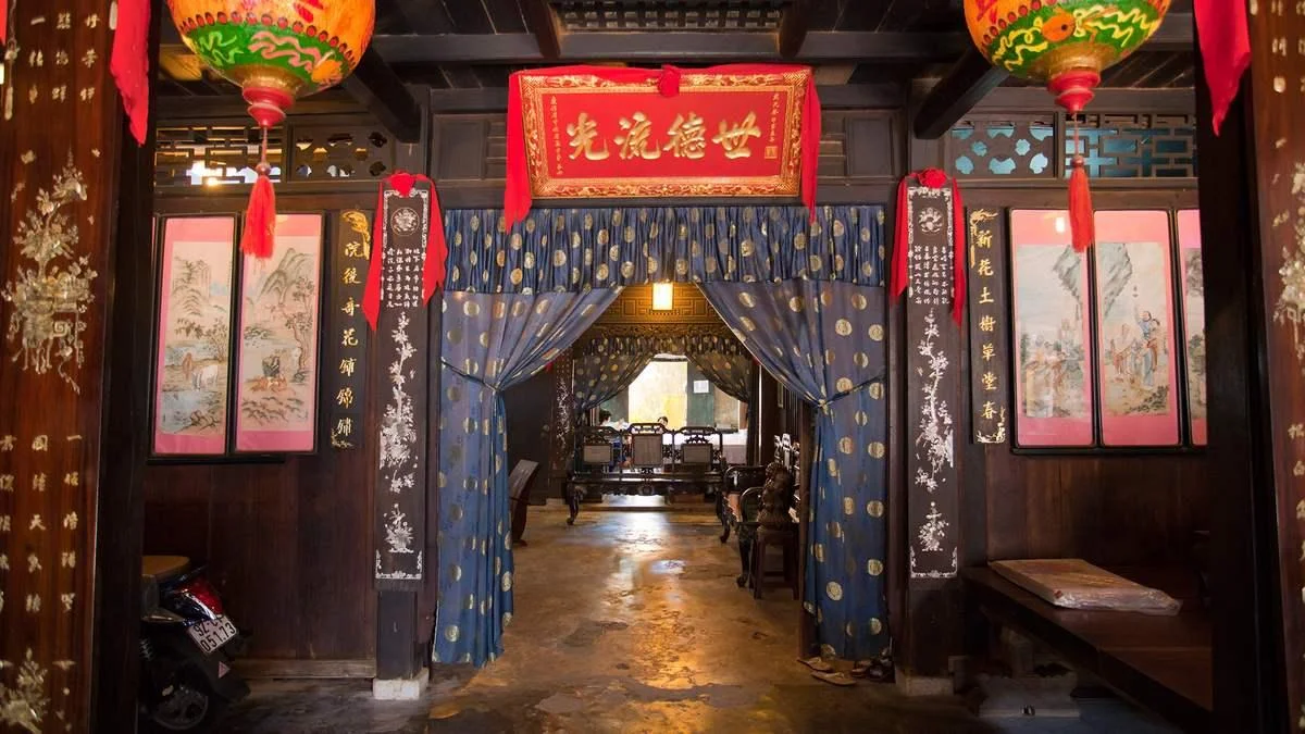
Hoi An Market
Located near the Thu Bon River, Hoi An Market is one of the liveliest places on the Hoi An Ancient Town Map. The market is a bustling hub where locals and visitors gather to shop, eat, and experience everyday life in the town.
Inside the market, visitors can find:
- Fresh fruits, vegetables, and seafood from nearby villages
- Popular local dishes such as cao lau, banh mi, and white rose dumplings
- Handmade souvenirs, textiles, and lanterns
The market is also a great starting point for exploring nearby streets and enjoying the vibrant atmosphere of Hoi An’s Old Town.
View more:
- Join a cooking class Hoi An and discover the flavors of authentic Vietnamese cuisine.
- Exclusive BBQ Tour Hoi An: Market, Bike & Countryside Feast
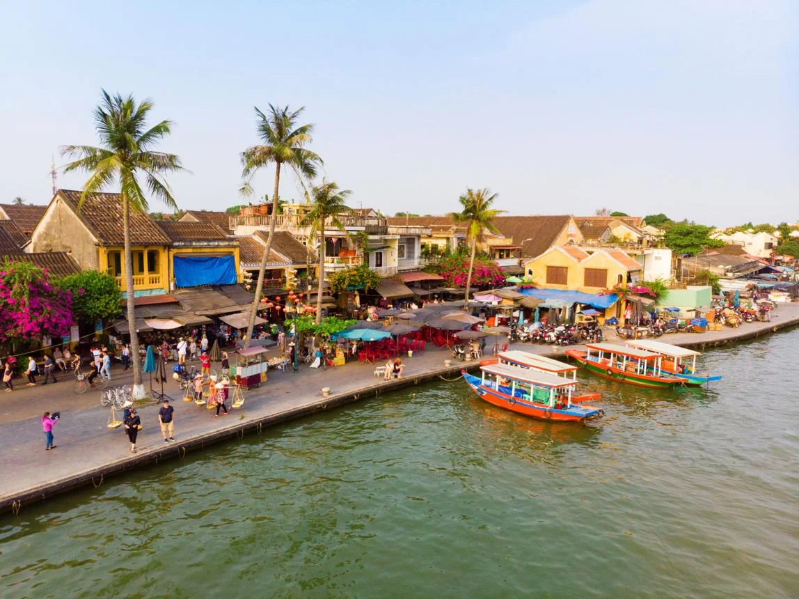
Map of Attractions Near Hoi An Ancient Town
While most landmarks are located within the Old Town, the Hoi An Ancient Town Map also connects visitors to many fascinating destinations in the surrounding areas. From traditional craft villages to beautiful beaches and ancient temples, these nearby attractions offer a deeper look into the culture and natural beauty of central Vietnam.
Tra Que Vegetable Village
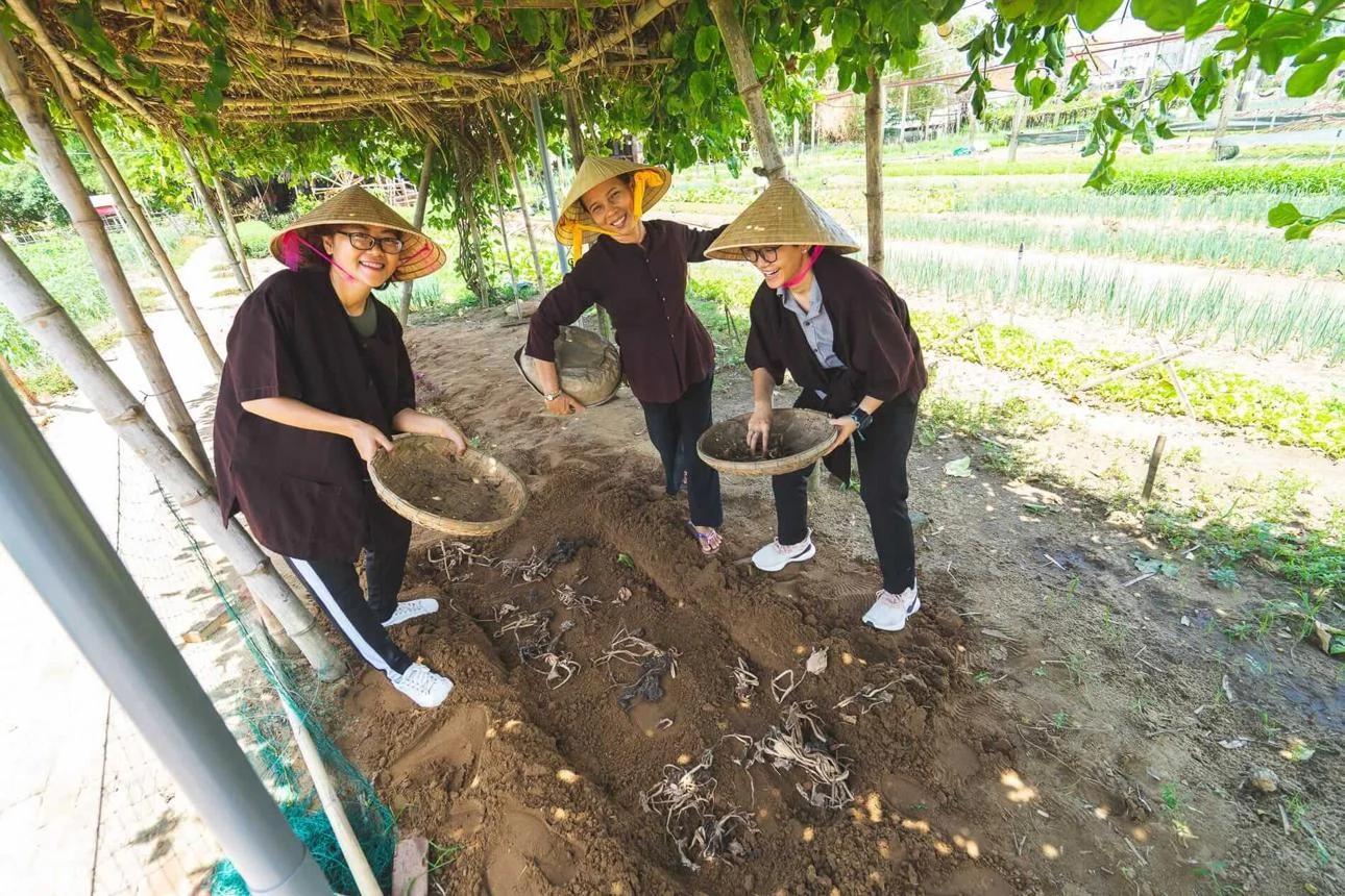
Located about 3 km from Hoi An Ancient Town, Tra Que Vegetable Village is famous for its organic farming traditions that date back more than 300 years. Local farmers grow a wide variety of herbs and vegetables using natural methods such as seaweed fertilizer from nearby lagoons.
Visitors can walk or cycle through the lush gardens, join farming experiences, or enjoy local dishes prepared with freshly harvested herbs. The village is especially known for contributing ingredients to popular Hoi An dishes like cao lau and banh xeo.
Cam Thanh Coconut Village
Cam Thanh Coconut Village, located about 5 km from Hoi An, is famous for its water coconut forest and traditional basket boat tours. Visitors can glide through narrow waterways surrounded by dense coconut palms while local guides demonstrate traditional fishing techniques.
The village played an important role during wartime when the coconut forest served as a natural shelter for local residents. Today, it has become one of the most popular eco-tourism destinations near Hoi An.
>>> View more: Eco-Luxury Hoi An Farming and Fishing Tour

Bay Mau Coconut Forest
Bay Mau Coconut Forest is part of the Cam Thanh ecological area. On the map of Hoi An Ancient Town, it appears just outside the Old Town and is a popular eco-tourism destination. The area features a network of small canals surrounded by lush water coconut trees. Visitors can enjoy basket boat rides, traditional fishing demonstrations, and local cultural performances. It offers a peaceful outdoor experience that contrasts with the historic streets of Hoi An Ancient Town.

Kim Bong Carpentry Village
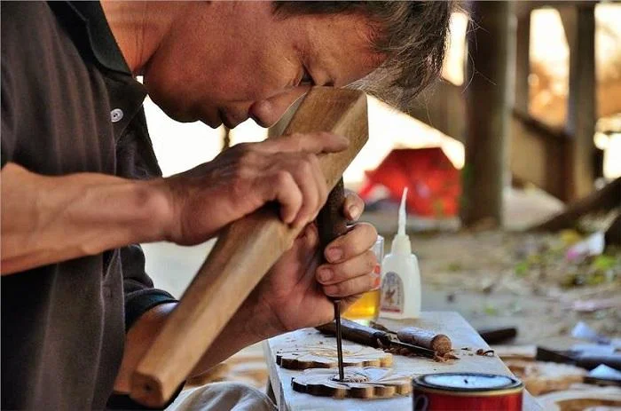
Located across the Thu Bon River, Kim Bong Carpentry Village has been known for its woodcraft traditions since the 16th century. On the map of Hoi An Ancient Town, the village appears just across the river from the historic center and is famous for its skilled artisans.
Craftsmen from Kim Bong helped build many of the historic houses, temples, and wooden structures found in Hoi An Ancient Town. Today, visitors can explore local workshops, watch artisans carving intricate wooden details, and learn about traditional woodworking techniques passed down through generations.
Thanh Ha Pottery Village
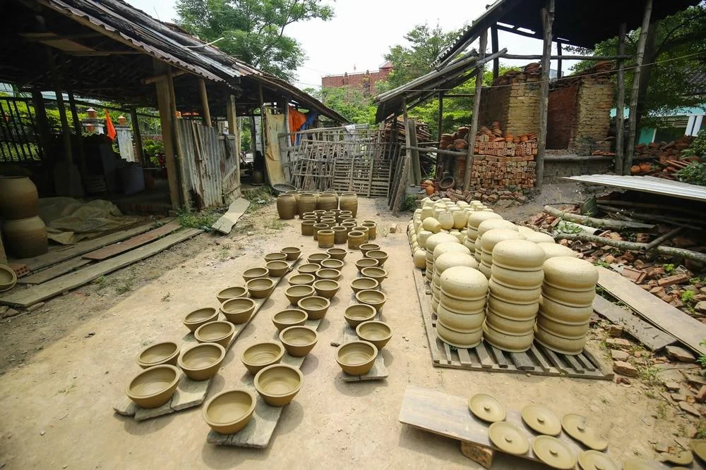
Located about 3 km west of the historic center, Thanh Ha Pottery Village is one of the oldest traditional craft villages near Hoi An. On the Hoi An Ancient Town map, the village appears just outside the Old Town and is famous for its centuries-old ceramic-making tradition.
Visitors can watch local artisans shape clay using traditional techniques, try making their own pottery, and explore Thanh Ha Terracotta Park, where miniature ceramic replicas of famous world landmarks are displayed.
An Bang Beach
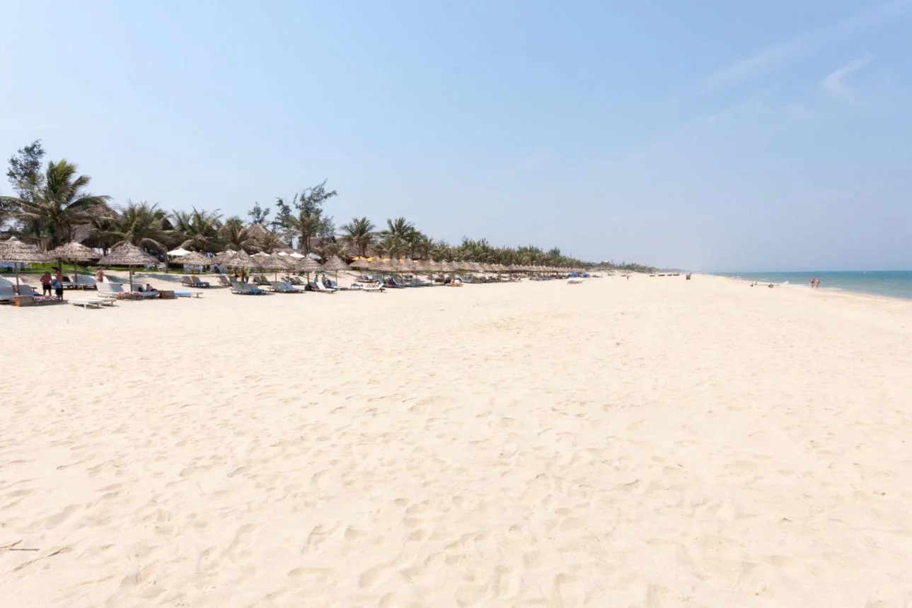
Located about 4 km from Hoi An, An Bang Beach is one of the most popular coastal destinations near the historic town. As shown on the map of Hoi An Ancient Town, the beach lies just east of the Old Town and is known for its soft white sand, clear water, and relaxed atmosphere.
Visitors can swim, sunbathe, or enjoy fresh seafood at beachfront restaurants. It’s a refreshing seaside getaway for travelers exploring Hoi An Ancient Town and its surrounding attractions.
View more: Top 8 Hoi An Beaches for Relaxing and Ocean Views
Cua Dai Beach
Located a few kilometers east of Hoi An, Cua Dai Beach was once the town’s most famous seaside destination. On the Hoi An Ancient Town map, it appears along the eastern coastline near the Old Town. Although parts of the beach have experienced erosion, visitors can still enjoy ocean views, seaside resorts, and boat trips departing from here to the Cham Islands.

Hidden Beach Hoi An
Hidden Beach Hoi An lies between An Bang Beach and Cua Dai Beach. On the Hoi An Ancient Town map, it is a small coastal spot known for its quieter and more relaxed atmosphere. The beach is less crowded and offers peaceful ocean views, small beach bars, and calm waters—perfect for travelers looking to escape the busy streets of Hoi An.

My Son Sanctuary
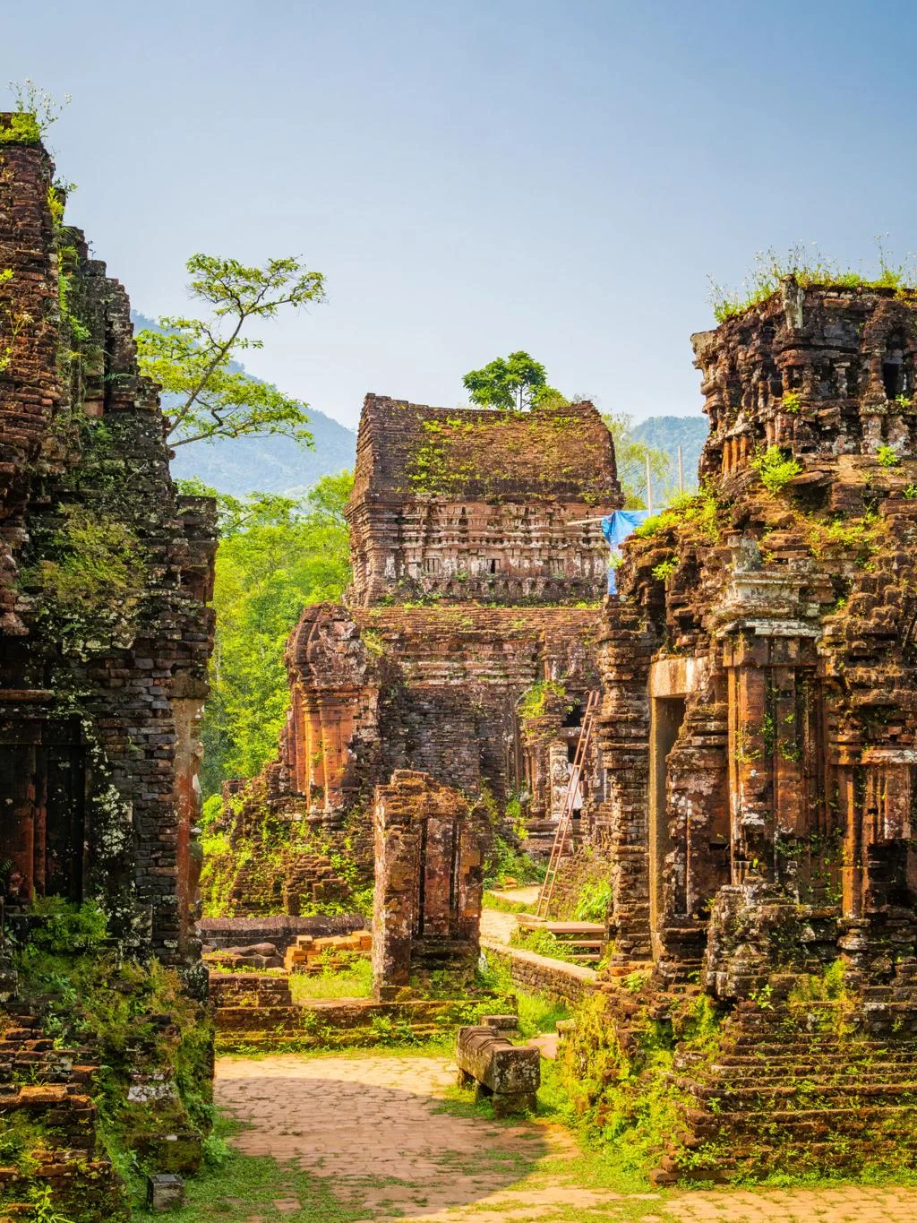
Located about 40 km from Hoi An, My Son Sanctuary is a UNESCO World Heritage Site and one of Vietnam’s most important historical landmarks. While it sits outside the main Hoi An Ancient Town map, it is one of the most popular day trips from the Old Town.
Built between the 4th and 13th centuries, the complex once served as the religious center of the Champa Kingdom. Visitors can explore ancient brick temples surrounded by lush jungle-covered hills.
>>> Explore My Son Sanctuary tour and uncover its ancient beauty.
Cham Island
About 15 km offshore from Hoi An, Cham Island (Cu Lao Cham) is a group of tropical islands known for clear waters and vibrant coral reefs. On the Hoi An Ancient Town map, it appears as a nearby island destination accessible by boat.
Travelers visit the islands for snorkeling, diving, island trekking, and beach relaxation. The area is also part of a UNESCO biosphere reserve, protecting its marine ecosystems and traditional fishing villages.
>>> Ready to see a different side of Hoi An? Experience the Unique Hoi An Rural & Urban Life Tour today.



Essential Tips for Using the Hoi An Vietnam Map
To make the most of your trip while using the Hoi An Ancient Town map, keep these helpful tips in mind:
- Download an offline map before exploring the Old Town in case your internet connection is limited.
- Visit early in the morning or in the evening to avoid the midday heat and large crowds.
- Wear comfortable walking shoes, as many streets in Hoi An Ancient Town are paved with cobblestones.
- Use famous landmarks such as the Japanese Covered Bridge or Hoi An Market as easy navigation points on the map of Hoi An Ancient Town.
- Explore small alleys and side streets, where you’ll often discover hidden cafés, local shops, and quiet corners.
Because the Old Town is compact, even first-time visitors can navigate it easily with a simple map of Hoi An Ancient Town.
FAQs About the Hoi An Ancient Town Map
Where can I get a detailed map of Hoi An Ancient Town?
You can find paper maps at most tourist information centers, hotels, and tailor shops around the Old Town. For convenience, we highly recommend downloading our digital Google Maps list or PDF version linked at the top of this article for offline GPS tracking.
Is Hoi An Ancient Town easy to navigate on foot?
Yes, it is incredibly easy. The Old Town is a compact, pedestrian-friendly grid made up of a few parallel streets (Tran Phu, Nguyen Thai Hoc, Bach Dang). Motorized vehicles are banned during most of the day, making walking safe and enjoyable.
How long does it take to walk around Hoi An Ancient Town?
A basic walking tour covering the main streets and taking photos takes about 2 to 3 hours. However, if you plan to enter multiple assembly halls, shop for tailored clothes, or stop at riverside cafes, you should allocate at least a half-day to fully experience the town.
Do I need a map to find the best food in Hoi An?
While you can easily stumble upon great street food, having a map helps you pinpoint famous spots like the Central Market, Ba Buoi Chicken Rice, or Madam Khanh the Banh Mi Queen, which are slightly tucked away from the main walking streets.
A Hoi An Ancient Town map helps visitors easily explore the historic streets, famous landmarks, and nearby attractions around the Old Town. With its compact layout, travelers can navigate the area on foot and discover temples, ancient houses, markets, and riverside views. Using a Hoi An Ancient Town map makes it simple to plan your route and enjoy the unique charm of this UNESCO heritage destination.
Recent Posts






Our Associations


Our Awards